
Republic of Vanuatu
Ripablik blong Vanuatu
République de Vanuatu
Ripablik blong Vanuatu
République de Vanuatu
Government type Parliamentary constitutional monarchy
Area 12,189 km² (4,706 sq mi)
Population 300,000 inh. (2020 census)
Population 321,000 inh. (2024 est.)
Population density 26 inh/km² (68 inh/mi²)
Area 12,189 km² (4,706 sq mi)
Population 300,000 inh. (2020 census)
Population 321,000 inh. (2024 est.)
Population density 26 inh/km² (68 inh/mi²)
Capital Port Vila (49,500 pop.)
Currency Vanuatu vatu
Human development index 0.607 (140th place)
Languages Bislama, French, English (all official)
Life expectancy M 69 years, F 73 years
Currency Vanuatu vatu
Human development index 0.607 (140th place)
Languages Bislama, French, English (all official)
Life expectancy M 69 years, F 73 years
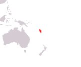
Boundaries:
Surrounded by the Pacific Ocean
GEOGRAPHY DATA OF VANUATU
Largest cities
Port Vila 49,500 pop.
Luganville 18,100 pop.
Highest mountains
Tabwemasana 1,879 m (6,165 ft)
Largest lakes
Letas 19 km² (7.3 sq mi)
Largest islands
Espiritu Santo 3,955 km² (1,527 sq mi)
Malakula 2,041 km² (788 sq mi)
Efate 899 km² (347 sq mi)
Erromango 892 km² (344 sq mi)
Ambrym 678 km² (262 sq mi)
Tanna 550 km² (212 sq mi)