
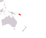
Solomon Islands
Government type Parliamentary constitutional monarchy
Area 28,400 km² (10,965 sq mi)
Population 721,000 inh. (2019 census)
Population 778,000 inh. (2024 est.)
Population density 27 inh/km² (71 inh/mi²)
Area 28,400 km² (10,965 sq mi)
Population 721,000 inh. (2019 census)
Population 778,000 inh. (2024 est.)
Population density 27 inh/km² (71 inh/mi²)
Capital Honiara (130,000 pop., 170.000 urban aggl.)
Currency Solomon Islands dollar
Human development index 0.564 (155th place)
Languages English (official), Pidgin-English, Melanesian indigenous languages
Life expectancy M 71 years, F 75 years
Currency Solomon Islands dollar
Human development index 0.564 (155th place)
Languages English (official), Pidgin-English, Melanesian indigenous languages
Life expectancy M 71 years, F 75 years
Boundaries:
Surrounded by the Pacific Ocean
GEOGRAPHY DATA OF SOLOMON ISLANDS
Largest cities
Honiara 130,000 pop., 170.000 urban aggl.
Tandai 19,900 pop.
Malango 8,500 pop.
Auki 6,700 pop.
Gizo 5,000 pop.
Highest mountains
Mount Popomanaseu 2,332 m (7,651 ft)
Largest lakes
Te'Nggano 155 km² (60 sq mi)
Largest islands
Guadalcanal 5,302 km² (2,047 sq mi)
Malaita 4,308 km² (1,663 sq mi)
Makira 3,190 km² (1,232 sq mi)
Santa Isabel 2,999 km² (1,158 sq mi)
Choiseul 2,971 km² (1,147 sq mi)
New Georgia 2,037 km² (786 sq mi)
ADMINISTRATIVE DIVISIONS OF SOLOMON ISLANDS
At the administrative level, the country is divided into 9 provinces, to which the capital district must be added; the Western province and that of Guadalcanal are those with the greatest extension, of just over 5,000 km², while the province of Malaita, corresponding to the homonymous island, is the most populated.The only city in the Solomon Islands is the capital Honiara, while all the others are at best small urban centers, with the majority of the population living in rural areas.