
Independent State of Samoa
Malo Sa'oloto Tuto'atasi o Samoa
Malo Sa'oloto Tuto'atasi o Samoa
Government type Parliamentary republic
Area 2,831 km² (1,093 sq mi)
Population 206,000 inh. (2021 census)
Population density 73 inh/km² (188 inh/mi²)
Area 2,831 km² (1,093 sq mi)
Population 206,000 inh. (2021 census)
Population density 73 inh/km² (188 inh/mi²)
Capital Apia (36,000 pop.)
Currency Samoan tala
Human development index 0.707 (111th place)
Languages Samoan, English (both official)
Life expectancy M 74 years, F 77 years
Currency Samoan tala
Human development index 0.707 (111th place)
Languages Samoan, English (both official)
Life expectancy M 74 years, F 77 years
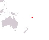
Boundaries:
Surrounded by the Pacific Ocean
GEOGRAPHY DATA OF SAMOA
Largest cities
Apia 36,000 pop.
Vaitele 8,200 pop.
Highest mountains
Mount Silisili 1,858 m (6,096 ft)
Largest islands
Savai'i 1,694 km² (654 sq mi)
Upolu 1,125 km² (434 sq mi)