
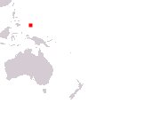
Republic of Palau
Beluu er a Belau
Beluu er a Belau
Government type Presidential republic
Area 416 km² (161 sq mi)
Population 17,600 inh. (2020 census)
Population 18,000 inh. (2024 est.)
Population density 43 inh/km² (112 inh/mi²)
Area 416 km² (161 sq mi)
Population 17,600 inh. (2020 census)
Population 18,000 inh. (2024 est.)
Population density 43 inh/km² (112 inh/mi²)
Capital Ngerulmud (320 pop.)
Currency United States dollar
Human development index 0.767 (80th place)
Languages Palauan, English (both official)
Life expectancy M 68 years, F 78 years
Currency United States dollar
Human development index 0.767 (80th place)
Languages Palauan, English (both official)
Life expectancy M 68 years, F 78 years
Boundaries:
Surrounded by the Pacific Ocean
GEOGRAPHY DATA OF PALAU
Largest cities
Koror 9,600 pop.
Highest mountains
Mount Ngerchelchuus 242 m (794 ft)
Largest islands
Babeldaob 331 km² (128 sq mi)
Peleliu 13 km² (5 sq mi)
Angaur 8 km² (3.1 sq mi)
Koror 8 km² (3.1 sq mi)