
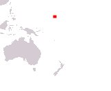
Republic of the Marshall Islands
Aolepan Aorokin Majel
Aolepan Aorokin Majel
Government type Parliamentary republic
Area 181 km² (70 sq mi)
Population 42,400 inh. (2021 census)
Population density 234 inh/km² (606 inh/mi²)
Area 181 km² (70 sq mi)
Population 42,400 inh. (2021 census)
Population density 234 inh/km² (606 inh/mi²)
Capital Majuro (23,200 pop.)
Currency United States dollar
Human development index 0.639 (131st place)
Languages English, Marshallese (both official)
Life expectancy M 71 years, F 75 years
Currency United States dollar
Human development index 0.639 (131st place)
Languages English, Marshallese (both official)
Life expectancy M 71 years, F 75 years
Boundaries:
Surrounded by the Pacific Ocean
GEOGRAPHY DATA OF MARSHALL ISLANDS
Largest cities
Ebeye 8,400 pop.
Delap 6,300 pop.
Highest elevation
10 m (33 ft) on Likiep Atoll
Largest islands
Kwajalein 16.4 km² (6.3 sq mi)
Mili 15.9 km² (6.1 sq mi)
Ailinglaplap 14.7 km² (5.7 sq mi)