
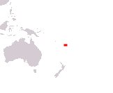
Republic of Fiji
Matanitu ko Viti
Fiji Ganarajya
Matanitu ko Viti
Fiji Ganarajya
Government type Parliamentary republic
Area 18,274 km² (7,056 sq mi)
Population 885,000 inh. (2017 census)
Population 903,000 inh. (2026 est.)
Population density 49 inh/km² (128 inh/mi²)
Area 18,274 km² (7,056 sq mi)
Population 885,000 inh. (2017 census)
Population 903,000 inh. (2026 est.)
Population density 49 inh/km² (128 inh/mi²)
Capital Suva (98,000 pop., 195,000 urban aggl.)
Currency Fijian dollar
Human development index 0.731 (111st place)
Languages English, Fijian, Fiji Hindi (all official)
Life expectancy M 67 years, F 71 years
Currency Fijian dollar
Human development index 0.731 (111st place)
Languages English, Fijian, Fiji Hindi (all official)
Life expectancy M 67 years, F 71 years
Boundaries:
Surrounded by the Pacific Ocean
GEOGRAPHY DATA OF FIJI
Largest cities
Suva 98,000 pop., 195,000 urban aggl.
Nasinu 95,000 pop.
Lautoka 71,600 pop.
Nadi 71,000 pop.
Nausori 57,900 pop.
Highest mountains
Mount Tomanivi 1,324 m (4,344 ft)
Longest rivers
Rewa 145 km (90 mi)
Sigatoka 120 km (75 mi)
Largest islands
Viti Levu 10,388 km² (4,011 sq mi)
Vanua Levu 5,587 km² (2,157 sq mi)
Taveuni 434 km² (168 sq mi)
Kadavu 411 km² (159 sq mi)
Gau 136 km² (52.5 sq mi)
Ovalau 106 km² (41 sq mi)
Koro 105 km² (40.5 sq mi)