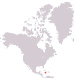
Home > North America > Jamaica

Jamaica
Government type Parliamentary monarchy
Area 10,991 km² (4,244 sq mi)
Population 2,698,000 inh. (2011 census)
Population 2,825,000 inh. (2024 est.)
Population density 257 inh/km² (666 inh/mi²)
Area 10,991 km² (4,244 sq mi)
Population 2,698,000 inh. (2011 census)
Population 2,825,000 inh. (2024 est.)
Population density 257 inh/km² (666 inh/mi²)
Capital Kingston (585,000 pop., 990,000 urban aggl.)
Currency Jamaican dollar
Human development index 0.709 (110th place)
Languages English (official), Jamaican Creole
Life expectancy M 73 years, F 76 years
Currency Jamaican dollar
Human development index 0.709 (110th place)
Languages English (official), Jamaican Creole
Life expectancy M 73 years, F 76 years
Boundaries:
Surrounded by the Atlantic Ocean (Caribbean Sea)
GEOGRAPHY DATA OF JAMAICA
Largest cities
Kingston 585,000 pop., 990,000 urban aggl.
Portmore 182,000 pop.
Spanish Town 147,000 pop.
Montego Bay 110,000 pop.
Highest mountains
Blue Mountain Peak 2,256 m (7,402 ft)
Longest rivers
Rio Minho 93 km (58 mi)
Black River 53 km (33 mi)
Largest islands
Jamaica 10,911 km² (4,213 sq mi)
ADMINISTRATIVE DIVISIONS OF JAMAICA
Jamaica is administratively divided into 14 parishes, with that of St. Ann just one square kilometer ahead of that of St. Elizabeth, and is the largest in the country; the two parishes of St. Andrew and St. Catherine, which include part of the capital and its urban agglomeration, are the most populated, with over half a million inhabitants each.The capital Kingston exceeds 500,000 inhabitants, with 3 other cities comprised between one hundred thousand and two hundred thousand people; in all there are 16 urban centers with at least 10,000 inhabitants, fairly well distributed on the island, albeit with a greater concentration to the west of the capital.