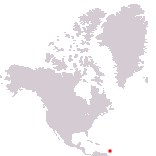
Home > North America > Barbados

Barbados
Government type Parliamentary republic
Area 430 km² (166 sq mi)
Population 266,000 inh. (2024 est.)
Population density 619 inh/km² (1,602 inh/mi²)
Area 430 km² (166 sq mi)
Population 266,000 inh. (2024 est.)
Population density 619 inh/km² (1,602 inh/mi²)
Capital Bridgetown (98,500 pop.)
Currency Barbadian dollar
Human development index 0.790 (70th place)
Languages English (official), Creole-English
Life expectancy M 78 years, F 80 years
Currency Barbadian dollar
Human development index 0.790 (70th place)
Languages English (official), Creole-English
Life expectancy M 78 years, F 80 years
Boundaries:
Surrounded by the Atlantic Ocean
GEOGRAPHY DATA OF BARBADOS
Largest cities
Bridgetown 98,500 pop.
Speightstown 3,600 pop.
Highest mountains
Mount Hillaby 340 m (1,115 ft)
Largest islands
Barbados 430 km² (166 sq mi)