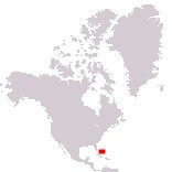
Home > North America > The Bahamas

Commonwealth of The Bahamas
Government type Parliamentary constitutional monarchy
Area 13,880 km² (5,359 sq mi)
Population 399,000 inh. (2022 census)
Population density 29 inh/km² (74 inh/mi²)
Area 13,880 km² (5,359 sq mi)
Population 399,000 inh. (2022 census)
Population density 29 inh/km² (74 inh/mi²)
Capital Nassau (297,000 pop.)
Currency Bahamian dollar
Human development index 0.812 (55th place)
Languages English (official), Creole-English
Life expectancy M 71 years, F 78 years
Currency Bahamian dollar
Human development index 0.812 (55th place)
Languages English (official), Creole-English
Life expectancy M 71 years, F 78 years
Boundaries:
Surrounded by the Atlantic Ocean
GEOGRAPHY DATA OF THE BAHAMAS
Largest cities
Nassau 297,000 pop.
Freeport 26,900 pop.
Highest mountains
Mount Alvernia 63 m (207 ft)
Largest lakes
Lake Rosa (about 1/4 of Great Inagua surface area)
Largest islands
North Andros 3,439 km² (1,328 sq mi)
Great Inagua 1,544 km² (596 sq mi)
South Andros 1,448 km² (559 sq mi)
Great Abaco 1,146 km² (442 sq mi)
Grand Bahama 1,096 km² (423 sq mi)
Long Island 596 km² (230 sq mi)
Eleuthera 457 km² (176 sq mi)