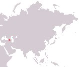
Republic of Armenia
Hayastani Hanrapetut'yun
Hayastani Hanrapetut'yun
Government type Parliamentary republic
Area 29,743 kmē (11,484 sq mi)
Population 2,933,000 inh. (2022 census)
Population density 99 inh/kmē (255 inh/miē)
Area 29,743 kmē (11,484 sq mi)
Population 2,933,000 inh. (2022 census)
Population density 99 inh/kmē (255 inh/miē)
Capital Yerevan (1,087,000 pop., 1,303,000 urban aggl.)
Currency Armenian dram
Human development index 0.759 (85th place)
Languages Armenian (official), Russian
Life expectancy M 68 years, F 79 years
Currency Armenian dram
Human development index 0.759 (85th place)
Languages Armenian (official), Russian
Life expectancy M 68 years, F 79 years
GEOGRAPHY DATA OF ARMENIA
Largest cities
Yerevan 1,087,000 pop., 1,303,000 urban aggl.
Gyumri 112,000 pop.
Vanadzor 75,200 pop.
Highest mountains
Mount Aragats 4,090 m (13,419 ft)
Longest rivers
Aras 1,072 km (666 mi) total, 192 km (119 mi) in Armenia
Akhurian 186 km (116 mi)
Largest lakes
Lake Sevan 1,276 kmē (493 sq mi), medium surface area
ADMINISTRATIVE DIVISIONS OF ARMENIA
Armenia is administratively divided into 10 provinces, to which the special district of the capital must be added; Syunik and Gegharkunik are the two largest provinces, while Kotayk, Armavir and Ararat compete for the primacy of the most populated province, each with around 250,000 inhabitants, a figure significantly lower than that of the district of the capital Yerevan, which hosts over 1 million people.Only Erevan and Gyumri, albeit slightly in his case, exceed one hundred thousand inhabitants; the main urban centers are concentrated in the area of the capital or in the north of the country, while to the south there are just a couple of them.

