
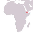
Republic of Djibouti
Jumhuriyah Jibuti
République de Djibouti
Jumhuriyah Jibuti
République de Djibouti
Government type Presidential republic
Area 23,200 km² (8,958 sq mi)
Population 1,035,000 inh. (2024 est.)
Population density 45 inh/km² (116 inh/mi²)
Area 23,200 km² (8,958 sq mi)
Population 1,035,000 inh. (2024 est.)
Population density 45 inh/km² (116 inh/mi²)
Capital Djibouti (674,000 pop.)
Currency Djiboutian franc
Human development index 0.509 (171st place)
Languages Arabic, French (official), Cushitic languages
Life expectancy M 62 years, F 65 years
Currency Djiboutian franc
Human development index 0.509 (171st place)
Languages Arabic, French (official), Cushitic languages
Life expectancy M 62 years, F 65 years
GEOGRAPHY DATA OF DJIBOUTI
Largest cities
Djibouti 674,000 pop.
Ali-Sabieh 37,900 pop.
Highest mountains
Mousa Ali 2,028 m (6,654 ft)
Longest rivers
Only non-permanent rivers
Largest lakes
Lake Abbe 450 km² (174 sq mi) total, including section in Ethiopia, medium surface area
Lake Assal 54 km² (21 sq mi)
Largest islands
Moucha 4 km² (1.5 sq mi)
ADMINISTRATIVE DIVISIONS OF DJIBOUTI
Djibouti is administratively divided into 6 regions, with the district of the homonymous capital equalized to the other provinces and where about 60% of the population lives; Dikhil and Tadjourah, with the same surface, are the two largest provinces.At the 2009 census, Djibouti had 6 cities over 10,000 inhabitants, the six chief towns of the relative regions, with only the capital Djibouti as a real city.