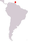
Home > South America > Trinidad and Tobago

Republic of Trinidad and Tobago
Government type Parliamentary republic
Area 5,128 kmē (1,980 sq mi)
Population 1,328,000 inh. (2011 census)
Population 1,368,000 inh. (2023 est.)
Population density 267 inh/kmē (691 inh/miē)
Area 5,128 kmē (1,980 sq mi)
Population 1,328,000 inh. (2011 census)
Population 1,368,000 inh. (2023 est.)
Population density 267 inh/kmē (691 inh/miē)
Capital Port of Spain (37,100 pop., 681,000 urban aggl.)
Currency Trinidad and Tobago dollar
Human development index 0.810 (57th place)
Languages English (official), Creole-English, Creole-French, Spanish, Hindi dialects
Life expectancy M 72 years, F 78 years
Currency Trinidad and Tobago dollar
Human development index 0.810 (57th place)
Languages English (official), Creole-English, Creole-French, Spanish, Hindi dialects
Life expectancy M 72 years, F 78 years

Boundaries:
Surrounded by the Atlantic Ocean
GEOGRAPHY DATA OF TRINIDAD AND TOBAGO
Largest cities
Chaguanas 83,500 pop.
San Fernando 48,800 pop.
Port of Spain 37,100 pop., 681,000 urban aggl.
Arima 33,600 pop.
Highest mountains
Cerro del Aripo 940 m (3,084 ft)
Longest rivers
Ortoire 50 km (31 mi)
Caroni 40 km (25 mi)
Largest islands
Trinidad 4,768 kmē (1,841 sq mi)
Tobago 298 kmē (115 sq mi)
ADMINISTRATIVE DIVISIONS OF TRINIDAD AND TOBAGO
The island of Trinidad is divided into 9 regions and 5 city municipalities, with Tobago being an autonomous region; the Sangre Grande and Rio Claro-Mayaro regions, which make up the eastern part of Trinidad, are the two largest administrative entities, while the Tunapuna-Piarco region has the largest number of inhabitants.There are 16 urban centers with at least 10,000 inhabitants, with the capital Port of Spain surmounted by Chaguanas, the only city not too far from 100,000 people, and San Fernando; the southeastern part of Trinidad and the island of Tobago are devoid of major population centers.
