Walking Holidays in Italy: Discover the Dolomites 9 Best Routes
The range mainly consists of dolomite, a light limestone rock giving the mountains their famous pale color. It has magnificent natural architecture with stunning landscapes: cliffs, spacious valleys, and dozens of glaciers. Most of the slopes are covered with mountain meadows, with pine and deciduous forests spreading in the lower part of the slopes. It is almost impossible to describe the beauty of the Dolomites on paper, but you can witness it during trekking in Italy. Luckily, there are plenty of walking routes for beginners and experienced hikers.
9 best Dolomites trails
The walkers may find a variety of ways to discover the Dolomites hiking guided tours from operators or independently organized treks. The main thing is to choose the right route. To make this task easier, we have selected the trails that might be interesting for you.Simple routes
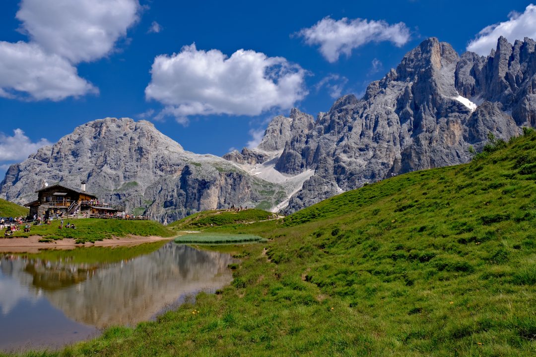
Some tourists do not have much hiking experience and still prefer walking to car trips. No worries, the Dolomites have something for everyone. Below you will find three suggested one-day hikes that can be easily completed by each traveler.Lago di Braies. The main attraction of this 4-km path is a crystal clear lake located 180 mts above sea level. The route is very simple and just circles the lake, opening spectacular views. The path is wide, with only a few stones. You will roughly need an hour to complete it, and even kids can effortlessly manage it. Usually, this hiking destination is crowded, but you may continue your hike and reach other stunning lakes and peaks on the way.
You can rent a boat and row across the lake for more breathtaking landscapes. Besides, you will find a lot of picnic spots along the trail. The easiest way to get to Lago di Braies is by car. This place is also the starting point of the Alta Via 1 hiking trail that runs through the eastern Dolomites for 160 km.
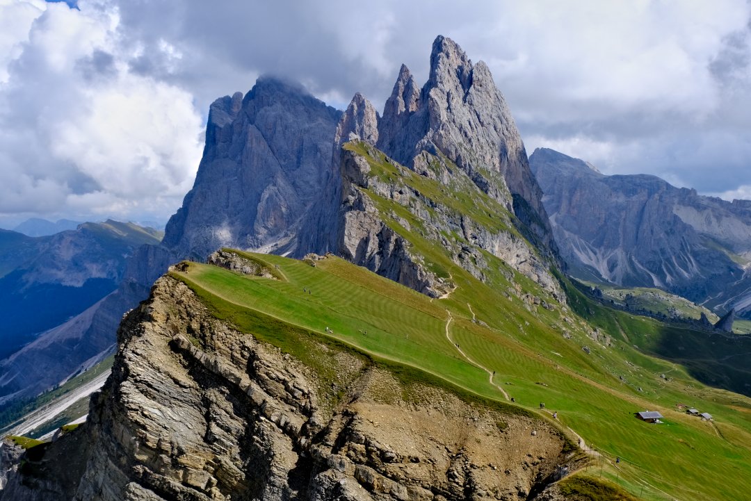
Seceda-Pieralongia. This trekking route is only 4km long and runs at an altitude of 158 mts. It will allow you to explore a loop path that connects two mountain stations and enjoy breathtaking views on the way. The route is easy, with only a few climbing areas, and ideal for beginners. During the hike, you will find plenty of stops to eat and refresh.
The starting and ending point of this trail is the Seceda cable car station. You can get to Seceda from Ortisei- Furnes Gondola station a trip in a cable car will take you 15-20 minutes, while the hike itself is 1.5 hours. Those with alpine experience will also find a lot of expert hiking routes in this area.
Adolf Munkel Trail. This trek is 9.2 km with an elevation of 378 mts. The hiking time is up to 3 hours. The route is located in the Puez-Odle Nature Park and leads you through the forests and alpine meadows. The starting point is parking lot Zanser Alm/Malga Zannes, where you can get by bus. There are several variants to do this trail clockwise and counterclockwise.
The whole path is well-marked, which allows you to enjoy it without a guide. Even if majority of the route goes through forests, there are a few openings with magnificent peak views. It is a fabulous variant for a family. If planned for the afternoon, you can enjoy one of the most stunning things in the Dolomites enrosadira. It is a unique light phenomenon when the peaks acquire a red tint in the rays of the setting sun. Go on a virtual tour right now!
Routes with average complexity
If you are not scared of steep inclines and some moderate load during your hiking adventures, consider the following three treks. They are short but will bring everlasting memories.Tre Cime di Lavaredo. The length of the trail is 10 km, with an elevation of 340 mts. This circular route around the peaks of Tre Cime di Lavaredo belongs to UNESCO World Heritage and is considered the most famous and unusual hiking path. You will see the iconic peaks of Cima Ovest, Cima Grande and Cima Piccola. Crowds of tourists come here for the breathtaking views of the rocks.
It will take approximately 3 to 5 hours, including stops and lunch at a mountain hut in the middle of the route. The path includes enough thrilling ascents and challenging, rocky descents. Hiking starts at the car park at Rifugio Auronzo. You can arrive there by car or take a bus from Cortina d'Ampezzo or Dobbiaco.
Cadini di Misurina. This route runs in the region of Veneto. It is a round trip of 3.2 km. The total ascent is only 130 mts. While this hike does not require special preparation, it provides fantastic panoramic views. The area has many beautiful stops, but make sure to reach the two main lookouts.
One of the viewpoints is a small peak with a very narrow path leading to it, so it is better to plan this trek for the dry weather. Generally, this path is short but includes a lot of steep drop offs. The hike starts at Rifugio Auronzo and proceeds along the Bonacossa Path. You will be rewarded with amazing sights from the first minutes of this hike.
Passo di Giau-Monte Mondeval. This trail will take you to a picturesque plateau in the eastern part of the Italian Dolomites in the province of Belluno. It covers an area of 4,344 hectares and opens some of the most stunning panoramic views. Besides, this place is known for some points of cultural interest, for example, the grave on an ancient hunter.
The trek is 13 km long, and you will need 5-6 hours to complete it. The path is comparatively easy and well-marked, but some rocky areas have slippery stones. It may also be a bit challenging for travelers with a fear of hights. The route starts in Passo di Giau. Even if this trail is considered a loop, the starting and finishing points are different, so a map will be necessary for better coordination.
Routes for advanced hikers
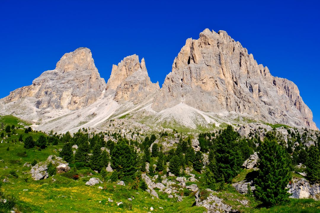
The Dolomites have enough trails to challenge even the most experienced hikers. Even if you have dozens of completed trails behind, you will be impressed by the majesty and impregnability of these mountains. Here are some options for hiking experts.Sassolungo (Langkofel). This 17 km route is one of the most tiring but also the most rewarding hiking trails in the Dolomites. It is located between Val Gardena and Val di Fassa and wraps the Sassolungo mountain group. You will walk at an altitude of about 2,200 mts and see the genuine beauty of these mountains - from lush meadows and alpine flowers to winding paths, rocky hills and breathtaking panoramic views.
The trek will take you 6-7 hours to complete. During the Sassolungo circuit you will find five mountain refuges with food, drinks and the overnight accommodation.
Alpe di Siusi. This spectacular trail stretches for 21 km. It starts at Alpe di Siusi, the largest highland pasture in Europe. The plateau is full of hiking and cycling paths leading to the Sassolungo, the Rosengarten mountains and the Schiliar massif. The route starts as an asphalt road, but after the first 3 km, you walk through forests. Alpe di Siusi is close to Selva di Val Gardena and Ortisei.
Note that the road to a starting point is closed between 9.00 am and 5.00 pm if you are not staying in a local hotel. Alternatively, you can get there by the Seiser Alm cable car. This hiking destination is open all the year round and includes a lot of hiking options. However, due to its big size, it is better to have a clear plan in advance and also check what mountain huts are open at your planned time.
Stiergarten. This trail is 13km long and requires 4-5 hours to complete. It starts in Sesto, at the foot of Tre Cime cable car, from where you climb to the picturesque meadows of Stiergarten. Besides, you will enjoy breathtaking views of the Tre Cime National Park. This trail can be continued as it also serves as a starting point for a few longer trails. You can get there by cable car from the Stiegarten and Drei Zinnen stations. The route itself is rather steep, so you must be fit for it, but the panoramic views will compensate the effort.
The above-described trails represent only a tiny portion of the wonders you can see in the Dolomites. Once you visit these mountains, you keep returning here again and again. There is something for every hiker here from guided tours to self-organized treks. Plan your next trip to discover the history and culture of this rich area.