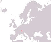
Principality of Liechtenstein
Fürstentum Liechtenstein
Fürstentum Liechtenstein
Government type Constitutional monarchy
Area 160 km² (62 sq mi)
Population 40,000 inh. (2024)
Population density 250 inh/km² (645 inh/mi²)
Area 160 km² (62 sq mi)
Population 40,000 inh. (2024)
Population density 250 inh/km² (645 inh/mi²)
Capital Vaduz (5,800 pop.)
Currency Swiss franc
Human development index 0.935 (16th place)
Languages German (official), Alemannic dialect
Life expectancy M 83 years, F 85 years
Currency Swiss franc
Human development index 0.935 (16th place)
Languages German (official), Alemannic dialect
Life expectancy M 83 years, F 85 years
GEOGRAPHY DATA OF LIECHTENSTEIN
Largest cities
Schaan 6,100 pop.
Vaduz 5,800 pop.
Triesen 5,500 pop.
Highest mountains
Grauspitz 2,599 m (8,527 ft)
Longest rivers
Rhine 1,320 km (820 mi) total, 41 km (25.5 mi) in Liechtenstein
Largest lakes
Gampriner Seele 0.026 km² (0.01 sq mi)
ADMINISTRATIVE DIVISIONS OF LIECHTENSTEIN
Liechtenstein is divided into 11 municipalities, consisting of towns with a maximum of a few thousand inhabitants, including the capital Vaduz.Triesenberg, with an area of 30 km², is the largest municipality, while Schaan (6,100 inhabitants) is the most populated one, slightly surpassing Vaduz.

