
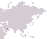
State of Qatar
Dawlat Qatar
Dawlat Qatar
Government type Constitutional monarchy
Area 11,627 km² (4,489 sq mi)
Population 2,846,000 inh. (2020 census)
Population 3,081,000 inh. (2024 est.)
Population density 265 inh/km² (686 inh/mi²)
Area 11,627 km² (4,489 sq mi)
Population 2,846,000 inh. (2020 census)
Population 3,081,000 inh. (2024 est.)
Population density 265 inh/km² (686 inh/mi²)
Capital Doha (872,000 pop., 2,160,000 urban aggl.)
Currency Qatari riyal
Human development index 0.855 (42nd place)
Languages Arabic (official), English
Life expectancy M 81 years, F 83 years
Currency Qatari riyal
Human development index 0.855 (42nd place)
Languages Arabic (official), English
Life expectancy M 81 years, F 83 years
GEOGRAPHY DATA OF QATAR
Largest cities
Doha 872,000 pop., 2,160,000 urban aggl.
Al Rayyan 800,000 pop.
Ad-Dawhah al-Mintaqat as-Sinayah 314,000 pop.
Highest mountains
Qurayn Abu al Bawl 103 m (338 ft)
Longest rivers
Only non-permanent rivers
Largest lakes
Only non-permanent lakes
ADMINISTRATIVE DIVISIONS OF QATAR
Qatar is made up of 8 municipalities, with that of Al Shahaniya being the largest and only one over 3,000 square kilometers, while the municipality of Doha, despite being the smallest one, is the most populated, with about 2/5 of the population of the country that lives here.All the major cities of Qatar are located in the central-eastern area of the territory, especially in the urban area of the capital Doha or on the coasts of the Persian Gulf; in all there were 12 urban centers over 25,000 inhabitants at the last census of 2020.