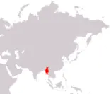
Republic of the Union of Myanmar
Pyidaunzu Thanmada Myama Nainngandaw
Pyidaunzu Thanmada Myama Nainngandaw
Government type Constitutional monarchy
Area 676,577 kmē (261,228 sq mi)
Population 51,375,000 inh. (2024 census)
Population density 76 inh/kmē (197 inh/miē)
Area 676,577 kmē (261,228 sq mi)
Population 51,375,000 inh. (2024 census)
Population density 76 inh/kmē (197 inh/miē)
Capital Naypyidaw (359,000 pop., 694,000 urban aggl.)
Currency Myanmar kyat
Human development index 0.609 (150th place)
Languages Burmese (official), indigenous idioms
Life expectancy M 67 years, F 72 years
Currency Myanmar kyat
Human development index 0.609 (150th place)
Languages Burmese (official), indigenous idioms
Life expectancy M 67 years, F 72 years

Boundaries:
Bangladesh and India NORTH-WEST
China NORTH-EAST
Laos EAST
Thailand SOUTH-EAST
Indian Ocean SOUTH-WEST
GEOGRAPHY DATA OF MYANMAR
Largest cities
Yangon 4,585,000 pop., 6,820,000 urban aggl.
Mandalay 1,163,000 pop., 1,753,000 urban aggl.
Naypyidaw 359,000 pop., 694,000 urban aggl.
Myitkyina 313,000 pop.
Bago 277,000 pop.
Mawlamyine 229,000 pop.
Highest mountains
Hkakabo Razi 5,881 m (19,295 ft)
Longest rivers
Mekong 4,350 km (2,703 mi) total, 270 km (168 mi) in Myanmar, it marks the entire border with Laos and about 30 km of that with China
Salween 2,815 km (1,749 mi) total, including parts in China and Thailand
Irrawaddy 2,170 km (1,348 mi)
Chindwin 1,207 km (750 mi)
Largest lakes
Indawgyi 130 kmē (50 sq mi)
Largest islands
Ramree 1,350 kmē (521 sq mi)
Cheduba 523 kmē (202 sq mi)
Kadan Kyun 450 kmē (174 sq mi)
ADMINISTRATIVE DIVISIONS OF MYANMAR
Myanmar is administratively divided into 7 regions and 7 states, with the latter differing from the first due to the presence of a particular ethnic minority; Shan State is the largest entity, with over 150,000 kmē of surface area, while the region of the former capital Yangon is home to the largest number of inhabitants.Two cities have more than 1 million inhabitants, Yangon, which is close to 5 million, and Mandalay, just above this threshold; the main urban centers are well distributed on the territory, even if there is a greater concentration in the central area.
