
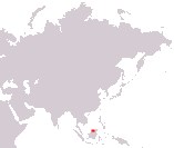
Nation of Brunei
Negara Brunei Darussalam
Negara Brunei Darussalam
Government type Absolute monarchy
Area 5,765 km² (2,226 sq mi)
Population 441,000 inh. (2021 census)
Population 454,000 inh. (2024 est.)
Population density 79 inh/km² (204 inh/mi²)
Area 5,765 km² (2,226 sq mi)
Population 441,000 inh. (2021 census)
Population 454,000 inh. (2024 est.)
Population density 79 inh/km² (204 inh/mi²)
Capital Bandar Seri Begawan (267,000 pop.)
Currency Brunei dollar
Human development index 0.829 (51st place)
Languages Malay (official), English, Chinese
Life expectancy M 76 years, F 78 years
Currency Brunei dollar
Human development index 0.829 (51st place)
Languages Malay (official), English, Chinese
Life expectancy M 76 years, F 78 years
GEOGRAPHY DATA OF BRUNEI
Largest cities
Bandar Seri Begawan 267,000 pop.
Kuala Belait 27,800 pop.
Seria 16,300 pop.
Highest mountains
Bukit Pagon 1,850 m (6,070 ft)
Longest rivers
Belait 206 km (128 mi)
Largest lakes
Tasek Merimbun
Largest islands
Borneo 743,330 km² (287,001 sq mi) total, less than 0.8% belongs to Brunei
Muara Besar 9.5 km² (3.7 sq mi)
ADMINISTRATIVE DIVISIONS OF BRUNEI
Brunei is administratively divided into 4 districts; that of Belait constitutes almost half of the territory, while the district of Brunei-Muara, where the capital is also located, is by far the most populated, with about 70% of the entire population of the country.More than half of the population lives in the capital Bandar Seri Begawan, with all the other towns much smaller and located along the coast, as the rest of the territory is mainly occupied by dense rainforest.