
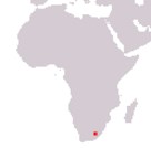
Kingdom of Lesotho
Naha ea Lesotho
Naha ea Lesotho
Government type Parliamentary constitutional monarchy
Area 30,355 km² (11,720 sq mi)
Population 2,007,000 inh. (2016 census)
Population 2,116,000 inh. (2024 est.)
Population density 70 inh/km² (181 inh/mi²)
Area 30,355 km² (11,720 sq mi)
Population 2,007,000 inh. (2016 census)
Population 2,116,000 inh. (2024 est.)
Population density 70 inh/km² (181 inh/mi²)
Capital Maseru (331,000 pop.)
Currency Lesotho loti
Human development index 0.514 (168th place)
Languages Sesotho, English (both official)
Life expectancy M 58 years, F 62 years
Currency Lesotho loti
Human development index 0.514 (168th place)
Languages Sesotho, English (both official)
Life expectancy M 58 years, F 62 years
GEOGRAPHY DATA OF LESOTHO
Largest cities
Maseru 331,000 pop.
Maputsoe 55,500 pop.
Mohale's Hoek 40,000 pop.
Highest mountains
Thabana Ntlenyana 3,482 m (11,424 ft)
Longest rivers
Orange 2,092 km (1,300 mi) total, 350 km (217 mi) in Lesotho
Caledon 480 km (298 mi) total, including the part in South Africa
ADMINISTRATIVE DIVISIONS OF LESOTHO
Lesotho is administratively divided into 10 districts, with Maseru and Thaba-Tseka being the largest, and the first being also the most populated with over half a million inhabitants.Only the capital Maseru exceeds one hundred thousand inhabitants, but several towns still have a decent population, around fifty and forty thousand inhabitants; a feature that can be clearly seen from the second map is that almost all the major urban centers are located near South Africa, while the inland is less densely populated.