
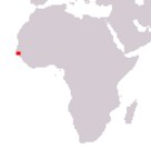
Republic of Guinea-Bissau
República da Guiné-Bissau
República da Guiné-Bissau
Government type Presidential republic
Area 36,125 km² (13,948 sq mi)
Population 1,521,000 inh. (2009 census)
Population 1,816,000 inh. (2024 est.)
Population density 50 inh/km² (130 inh/mi²)
Area 36,125 km² (13,948 sq mi)
Population 1,521,000 inh. (2009 census)
Population 1,816,000 inh. (2024 est.)
Population density 50 inh/km² (130 inh/mi²)
Capital Bissau (492,000 pop., 617,000 urban aggl.)
Currency West African CFA franc
Human development index 0.483 (177th place)
Languages Portuguese (official), Portuguese Creole, regional languages
Life expectancy M 56 years, F 60 years
Currency West African CFA franc
Human development index 0.483 (177th place)
Languages Portuguese (official), Portuguese Creole, regional languages
Life expectancy M 56 years, F 60 years
GEOGRAPHY DATA OF GUINEA-BISSAU
Largest cities
Bissau 492,000 pop., 617,000 urban aggl.
Gabú 44,000 pop.
Bafatá 30,000 pop.
Highest elevation
300 m (984 ft) in the south-east of the country
Longest rivers
Corubal 560 km (348 mi) total, with the part in Guinea
Geba 550 km (342 mi) total, including sections in Guinea and Senegal
Cacheu 257 km (160 mi)
Largest islands
Pecixe 168 km² (65 sq mi)
Formosa 140 km² (54 sq mi)
Orango 123 km² (47 sq mi)
ADMINISTRATIVE DIVISIONS OF GUINEA-BISSAU
Guinea-Bissau is administratively divided into 8 regions, with the capital Bissau forming a separate district with similar status; Gabú, with just under ten thousand square kilometers of surface area, is the largest region, while Bissau occupies the first place in terms of the number of inhabitants.Only the capital Bissau can be considered a real city, while two other inhabited centers have more than 25,000 inhabitants, with all the other main settlements being simple villages.