
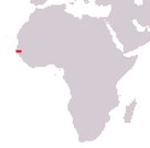
Republic of The Gambia
Government type Presidential republic
Area 10,689 km² (4,127 sq mi)
Population 1,857,000 inh. (2013 census)
Population 2,560,000 inh. (2024 est.)
Population density 239 inh/km² (620 inh/mi²)
Area 10,689 km² (4,127 sq mi)
Population 1,857,000 inh. (2013 census)
Population 2,560,000 inh. (2024 est.)
Population density 239 inh/km² (620 inh/mi²)
Capital Banjul (31,100 pop., 1,556,000 urban aggl.)
Currency Gambian dalasi
Human development index 0.500 (174th place)
Languages English (official), regional languages
Life expectancy M 60 years, F 63 years
Currency Gambian dalasi
Human development index 0.500 (174th place)
Languages English (official), regional languages
Life expectancy M 60 years, F 63 years
GEOGRAPHY DATA OF GAMBIA
Largest cities
Brikama 81,000 pop., 1,556,000 urban aggl.
Bundunka Kunda 55,400 pop.
Highest elevation
53 m (174 ft)
Longest rivers
Gambia 1,130 km (702 mi) total, 475 km (295 mi) in Gambia
Largest islands
MacCarthy 13 km² (5 sq mi)
ADMINISTRATIVE DIVISIONS OF GAMBIA
The Gambia is divided into 5 regions, to which the capital Banjul is added; these were later joined by 8 local government areas (Banjul, Basse, Brikama, Janjanbureh, Kanifing, Karewan, Kantaur and Mansakonko), which perform the first level administrative function and which are in turn divided into 43 districts; the Central River region is the largest, while the West Coast is the most populated.With the exception of Farafenni, all the major inhabited centers are located in the area of the capital Banjul and form practically a single large urban area, made up by large villages and not real cities; in the rest of the Gambia there are only smaller towns.