
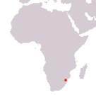
Kingdom of Eswatini
Umbuso weSwatini
Umbuso weSwatini
Government type Absolute monarchy
Area 17,364 km² (6,704 sq mi)
Population 1,093,000 inh. (2017 census)
Population 1,202,000 inh. (2024 est.)
Population density 69 inh/km² (179 inh/mi²)
Area 17,364 km² (6,704 sq mi)
Population 1,093,000 inh. (2017 census)
Population 1,202,000 inh. (2024 est.)
Population density 69 inh/km² (179 inh/mi²)
Capital Mbabane (60,700 pop.) executive
Capital Lobamba (11,000 pop.) legislative
Currency Swazi lilangeni
Human development index 0.597 (144th place)
Languages siSwati, English (both official)
Life expectancy M 56 years, F 65 years
Capital Lobamba (11,000 pop.) legislative
Currency Swazi lilangeni
Human development index 0.597 (144th place)
Languages siSwati, English (both official)
Life expectancy M 56 years, F 65 years
Note
On the occasion of the 50th anniversary of independence, on 19 April 2018 the country changed its name to Eswatini, which means "land of the Swazis", partly also to no longer be confused with Switzerland, name very similar to Swaziland.
GEOGRAPHY DATA OF ESWATINI
Largest cities
Mbabane 60,700 pop.
Manzini 30,200 pop.
Highest mountains
Emlembe 1,862 m (6,109 ft)
Longest rivers
Lusutfu (or Maputo) 300 km (186 mi) total, with parts in South Africa and Mozambique
ADMINISTRATIVE DIVISIONS OF ESWATINI
The country is divided into 4 regions with a fairly similar extension (that of Lubombo the largest); Manzini and Hhoho, with over 300,000 inhabitants each, are the two most populated regions.The latest census reported the presence of only 7 inhabited centers with at least 5,000 inhabitants, with Mbabane and Manzini as the only cities, while all the other settlements had fewer than 12,000 people.