
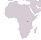
Republic of Burundi
Repubulika yu Burundi
République du Burundi
Repubulika yu Burundi
République du Burundi
Government type Presidential republic
Area 27,834 km² (10,747 sq mi)
Population 12,333,000 inh. (2024 census)
Population density 443 inh/km² (1,148 inh/mi²)
Area 27,834 km² (10,747 sq mi)
Population 12,333,000 inh. (2024 census)
Population density 443 inh/km² (1,148 inh/mi²)
Capital Gitega (205,000 pop.)
Currency Burundian franc
Human development index 0.439 (187th place)
Languages English, French, Kirundi (all official)
Life expectancy M 62 years, F 66 years
Currency Burundian franc
Human development index 0.439 (187th place)
Languages English, French, Kirundi (all official)
Life expectancy M 62 years, F 66 years
GEOGRAPHY DATA OF BURUNDI
Largest cities
Bujumbura 375,000 pop., 1,196,000 urban aggl.
Gitega 205,000 pop.
Highest mountains
Mount Heha 2,684 m (8,806 ft)
Longest rivers
Nile 6,850 km (4,256 mi) total, small portion in the initial part
Kagera 690 km (429 mi) total, with sections in Rwanda, Tanzania and Uganda, considered the source branch of the Nile
Malagarasi 475 km (295 mi) total, including the stretch in Tanzania
Ruvubu 300 km (186 mi) total, with the part in Tanzania
Largest lakes
Tanganyika 32,893 km² (12,700 sq mi) total, 1,800 km² (695 sq mi) in Burundi
Rweru 100 km² (39 sq mi) total, 80 km² (31 sq mi) in Burundi
ADMINISTRATIVE DIVISIONS OF BURUNDI
Burundi from 2025 is administratively divided into only 5 provinces (from 18 previously), Buhumuza, Bujumbura, Burunga, Butanyerera and Gitega.At the 2008 census there were only 10 inhabited centers with at least 10,000 inhabitants and a single large city, Bujumbura, the capital at that time; the main settlements are mainly located in the north-west of the country.